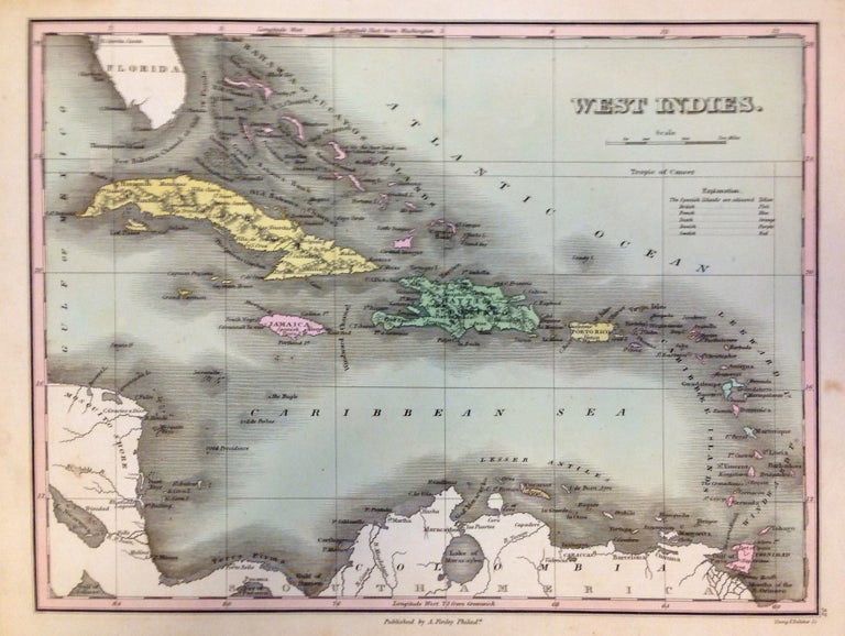
West Indies
Philadelphia: Anthony Finley, 1824.
Map. Engraving with original hand coloring. Image measures 8.5" x 11.25".
This lovely 1824 map by Anthony Finley features the West Indies and Caribbean Islands. Extends from southern Florida to northern South America and includes the Bahamas, the Leeward and Windward Islands. Cat Isle in the Bahamas is noted as 'the first land seen by Columbus, 1492'. The map is beautifully detailed and notes the important cities and some topographic features. The map is in good condition with minor toning and foxing. Original plate mark is visible. Lower margin shows tear, not affecting printed image.
Anthony Finley (c. 1790-1840) was a prominent American cartographic publisher in the early 19th century. This map was published in "A New General Atlas", which was well received and praised for its clearness and accuracy. Concise coloring matches the index of Colonial activity.
Illustrator: Young & Delleker
Binding: Unbound
Language: English
Price: $250.00
Item #270813