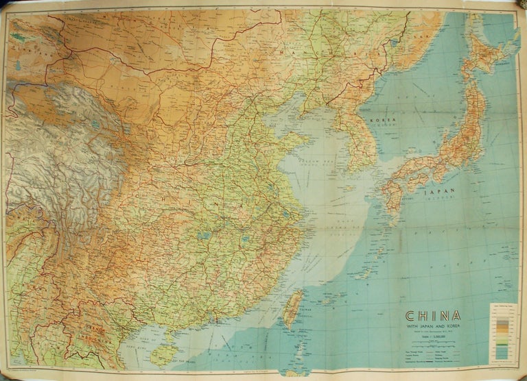
China with Japan and Korea
Edinburgh: John Bartholomew & Sons Ltd.
Map. Color lithograph. Sheet measures 28 x 39".
This large circa 1940 map by John Bartholomew depicts China, Japan and Korea in incredible detail. Covers from the Gulf of Martaban South Sakhalin and includes all of Korea, Japan and China. Color coded to show elevation, the map notes numerous cities, towns, roads, rivers, railways, canals, shipping routes, islands and a host of other topographical features. Coastal features are also detailed. A key in the lower right notes the layer coloring scale. The map is flattened and lined with archival paper. Shows some wear along the original folds and minor toning. Minor spotting at places. Accompanied by, but detached from original cover.
John Bartholomew (1831-1893) was a Scottish cartographer known throughout Great Britain for his finely produced maps, often in color. This map is a fine example of his work.
Binding: Unbound
Language: English
Price: $350.00
Item #269442