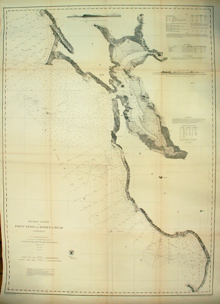
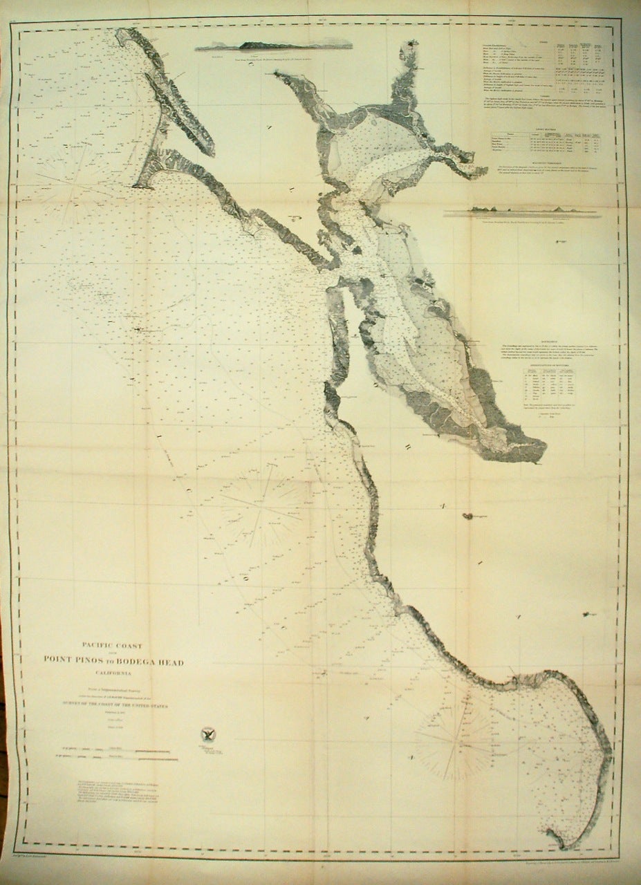
Pacific Coast from Point Pinos to Bodega Head California; San Francisco Bay Area
Washington: Government Printing Office, 1866.
Map. Uncolored lithograph. Sheet measures 41.75" x 30.5".
This exceptional sea chart issued by the United States Coast Survey in 1866 beautifully depicts the San Francisco Bay. The chart extends from Point Pinos and Monterey Bay northward to Bodega Bay and includes the whole of San Francisco Bay and San Pablo Bay. Offers inland detail along the coast and details the city of San Francisco. Oakland, Napa, Petaluma, Brooklyn, Union City, Vallejo, Redwood City, Alviso, Monterrey, Santa Cruz, and others are also identified. Point Pinos Lighthouse, the oldest continuously operating lighthouse on the western coast, built in 1855, is identified.
The map notes numerous depth soundings throughout and notes other important maritime details including bays, sounds, islands, shoals, lighthouses, beacons, etc. Includes two elevation profile views and notes on tides, soundings, etc. This map, issued shortly following the California Gold Rush, is one of the most desirable charts issued by the Coast Survey.
The triangulation for this chart was completed by R. D. Cutts, G. A. Fairfield, G. Davidson, A.F. Rodgers, and W. E. Greenwell. The topography was executed by R. D. Cutts, A. F. Rodners, A.M. Harrison, J. S. Lawson and W. M. Johnson. The hydrography is the work of Commander James Alden, Commander R. M, Cuyler, Commander B. F. Sands, A. F. Rodgers, E. Cordell, and others. This chart was prepared under the supervision of A. D. Bache, Superintendent. First published in 1862, updated to 1866. The map is in good condition with some wear along the original folds and minor spotting. The whole is flattened and lined with archival paper.
Alexander Dallas Bache (1806-1867) was an incredibly prolific surveyor, who worked as the superintendent of the United States Coast Survey, which was first established in 1807. Over the course of the 19th century, the survey worked closely with the U.S. Navy to produce sea charts of the country's waters that could serve scientific as well as military functions. This crisp and bright sea chart of the waters around San Francisco is a beautiful document of this historical effort.
Binding: Unbound
Language: English
Price: $450.00
Item #269025