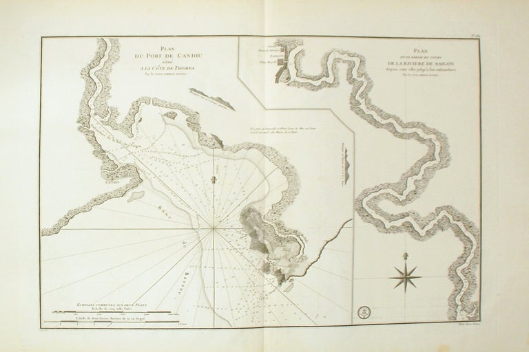
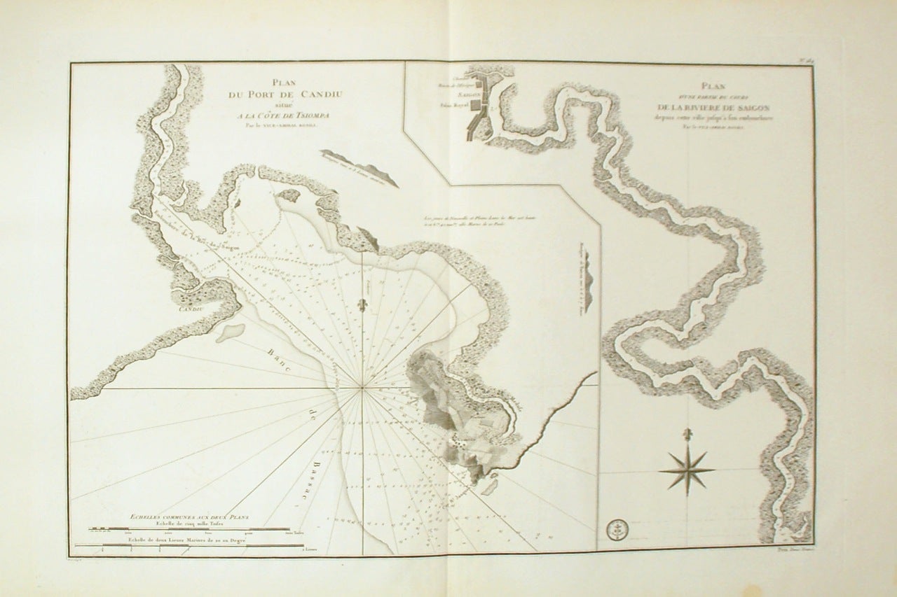
Plan d'une partie du cours de la Riviere de Saigon depuis cette ville jusqu'a son embouchure. Plan du port de Candiu situe a la cote de Tsiompa.
Paris: Depot General de Marine.
Sea chart. Uncolored engraving. Image measures 19" x 27.5"
This unusual circa 1800 sea chart by the Depot de la Marine depicts the Saigon River in modern day Vietnam. The map, divided into two sections, follows the course of the river from Saigon City (Ho Chi Minh City) south to the mouth of the Saigon River and Vung Tau. The port of Candiu is identified on the coast of Tsiompa. Tsiompa refers to the ancient Indochinese kingdom of Champa which existed between the 2nd and 17th century. Vountao (Vung Tao) is exceptionally detailed with beautifully rendered topography to the level of individual fields and plantations. Depth soundings are labeled though out the river and coastal features are noted. The Royal Palace of Saigon is also detailed.
Vung Tau, originally known as Tam Thang, earned its name (which means 'anchorage') after European trading ships started frequenting the region during the 14th and 15th centuries. During the late 18th and early 19th century, Malay pirates made this a base. The French Indochinese government named it Cap Saint-Jacques (also noted here). The map is in good condition with minimal wear along the original centerfold. Minor offsetting and some spotting in the margins. Wide margins with original plate mark visible.
Depot General de la Marine was a French hydrographic mapping organization similar to the United States Coast Survey or the British Admiralty. Some of the important cartographers associated with the Depot include Jacques Nicholas Bellin and Riobert Bonne. This is a wonderful example of the Depot's extensive work.
Binding: Unbound
Language: English
Price: $1,500.00
Item #267907