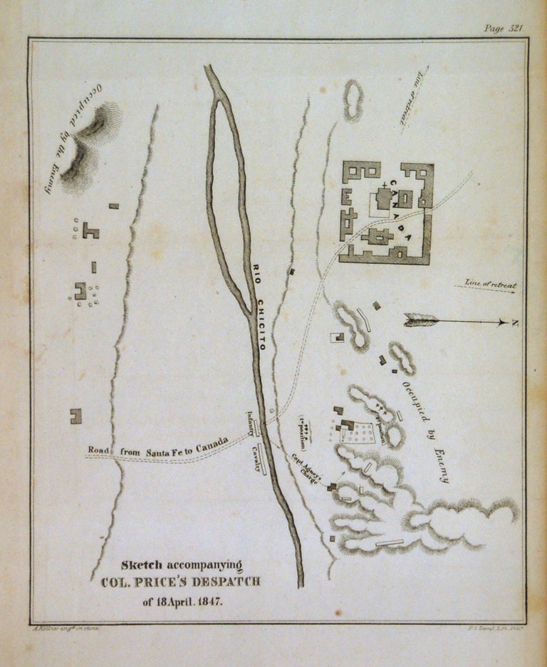
Sketch accompanying Col. Price's Despatch of 18 April. 1847
Washington D.C. Wendell and Van Benthuysen, 1847.
Map. Uncolored engraving. Image measures 8.25" x 7.5".
This battle plan depicts the route of the Col. Sterling Price's movements during the Mexican-American War on 18th April,1847 along the road from Santa Fe to Canada, near the Rio Chicito (Little Colorado River or Flax River). The movements of the army are clearly marked with topography beautifully depicted and enemy positions marked. It is in vey good condition with no chips with minor wear along the folds. The map appeared in Emory's "Notes of a Military Reconnoissance," first published as a Senate Executive Document in the aftermath of the Mexican-American War.
William Hemsley Emory (1811-1887) was a United States Army officer and surveyor of Texas. After serving in the Mexican-American War, he helped conduct the land surveys that would determine the border between the U.S. and Mexico established in the Treaty of Guadalupe-Hidalgo. This map is a fascinating military document.
Binding: Unbound
Language: English
Price: $300.00
Item #267680