
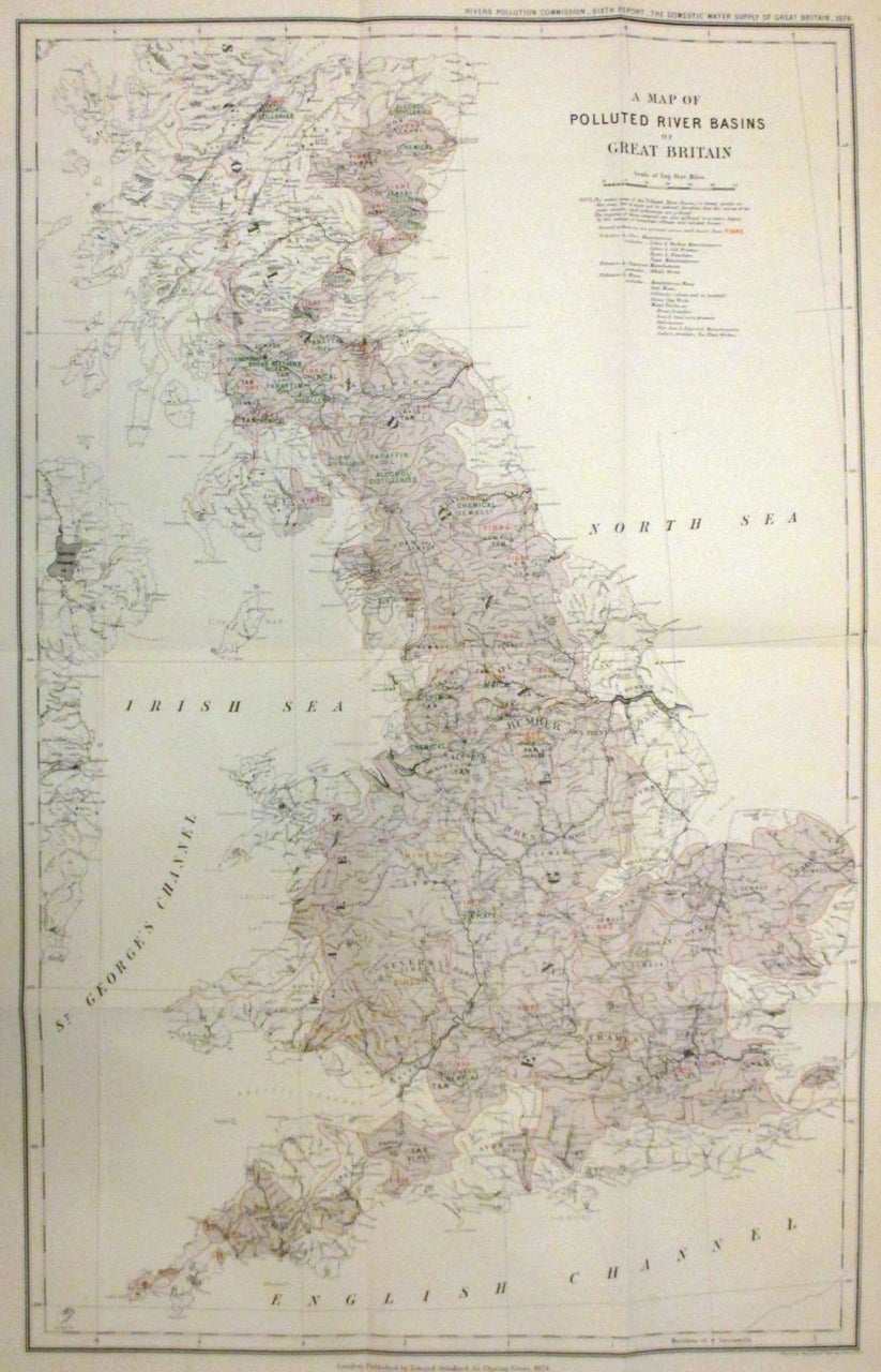
A Map of Polluted River Basins of Great Britain
London: Edward Stanford, 1874.
Map. Colored engraving. Image measures 22.5 x 14.5".
This interesting map of Great Britain covers England, Wales and a large part of Scotland and shows the polluted river basins of the region. The entire area of the polluted river basins is tinted in purple. Several types of pollution are noted throughout the map, including fiber, sewage, chemical, tan, mines, etc. Important cities, ports, bays, towns, and islands are identified.
The map was prepared for The Rivers Pollution Commission. Published by Edward Stanford and issued in the 1874 "Sixth Report of the Commissioners appointed in 1868 to inquire into the best means of preventing the pollution of rivers. The domestic water supply of Great Britain". The report was presented to both houses of Parliament by command of Her Majesty. The map is in very good condition with minor wear along the folds and some foxing.
Binding: Unbound
Language: English
Price: $450.00
Item #266348