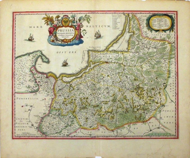
Prussia Accurate Descripta a Gasparo Henneberg Erlichensi
Amsterdam: Jansson, J.
Map. Hand colored engraving. Image measures 15" x 19 1/4".
Detailed map of Prussia depicts parts of Poland and Lithuania and dates to circa 1636. It extends from the Baltic Sea south as far as Thorn and beautifully depicts forests and mountains in profile. Important cities and rivers are labeled. A beautifully engraved title cartouche adorns the top left corner and illustrations of ships in the Baltic Sea. The map is in good condition with minor wear along the centerfold with minor edge wear. Foxing at places.
Jan Jansson was part of an influential family of map publishers from the Netherlands throughout the 17th century and beyond. They were based in Arnhem then in Amsterdam. They were printers, publishers and booksellers. Major publications were under the joint ownership of the Jansson heirs and their printing empire. This is a beautiful example of his work.
Binding: Unbound
Language: English
Price: $550.00
Item #265508