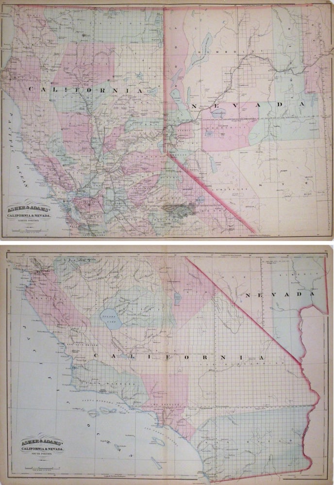
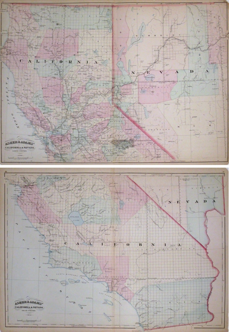
Asher and Adams' California & Nevada. North Portion. Asher and Adams' California & Nevada. South Portion.
New York: Asher & Adams, 1872.
Set of 2 Maps. Lithograph original hand coloring. Each sheet measures 17 1/2 x 24".
This interesting pair of maps depict the States of California and Nevada divided on two separate sheets. With special focus on the developing railroad systems, the maps show early counties not yet present, including Orange, Riverside and Imperial. Early railroad lines, including the Napa Valley and the California Pacific Railroad, the Bloomfield Railroad, the Visalia Railroad, the Stockton Railroad Virginia & Truckee railroad are included in the the north sheet. The southern sheet is relatively devoid of railway lines, with the only railroad depicted near Santa Clara and Los Angeles. The map also notes several gold and silver boom towns. Features late nineteenth century township grid, counties, railroads, cities, towns, lakes, marshland, and notable geographic features. At places, the map extends outside the border. Both maps are in good condition, although the center seam is torn and there are scattered tears and chips at the edges. Asher & Adams were publishers based in Washington and New York in the late 19th century who produced some of the most detailed and colorful atlases of the period. This is a wonderful example of their work.
Binding: Unbound
Language: English
Price: $350.00
Item #264472