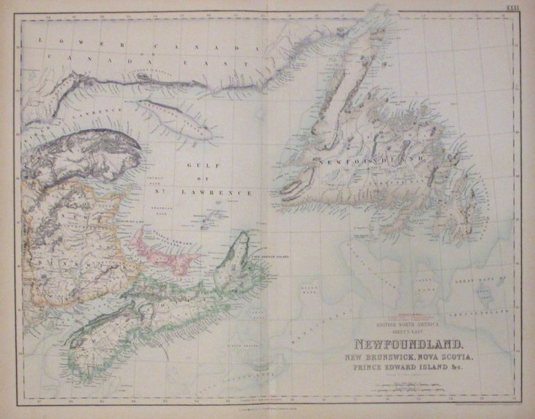
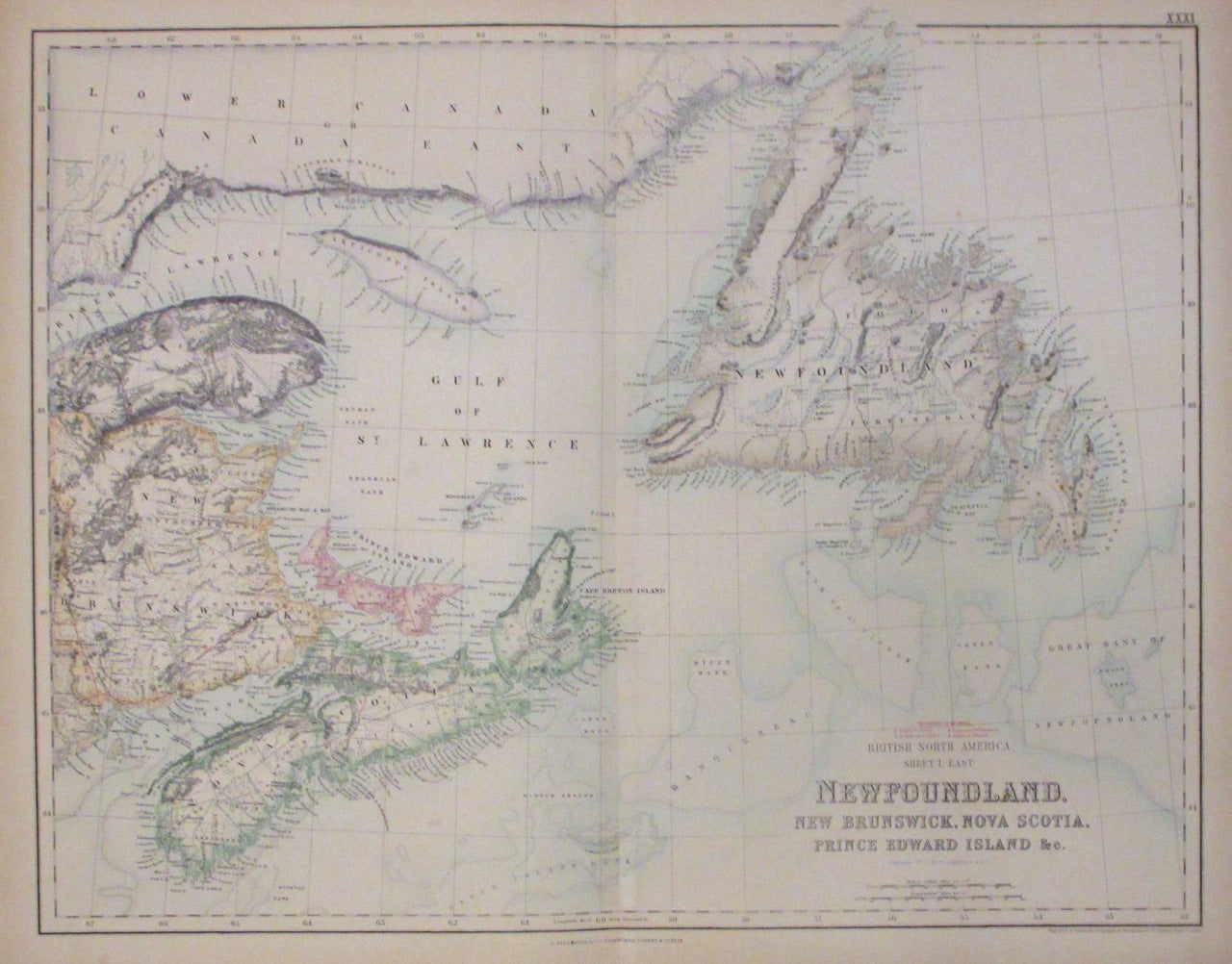
British North America, Sheet 1, East. Newfoundland, New Brunswick, Nova Scoria, Prince Edward Island etc.
Edinburgh: Fullarton, Archibald, 1862.
Map. Color engraving. Image measures 16" x 20 3/4". 1862.
This is a wonderful map of the East Coast of Canada, covering Nova Scotia, New Brunswick, Newfoundland and Prince Edwards Island. The two islands (Nova Scotia and Newfoundland) as well as Prince Edward Island, are shown as they are situated off the coasts of New Brunswick and Labrador. Each is abundantly labeled with the names of cities, ports, rivers, mountains, and most importantly, bays and harbors, as these sites were the keys to the economic prosperity with the 19th-century market. From Fullarton's "Royal Illustrated Atlas", considered the last highly decorative atlas published in England. Beautifully engraved and colored with a mixture of printed color and hand color. Engraved by J. Hugh Johnson. Map is in good condition with small chips and tears along edges and centerfold. Archibald Fullarton was a prominent Glasgow-based publisher who worked under the firm of A. Fullarton & Co. This is a fine example of his work.
Binding: Unbound
Language: English
Price: $100.00
Item #264467