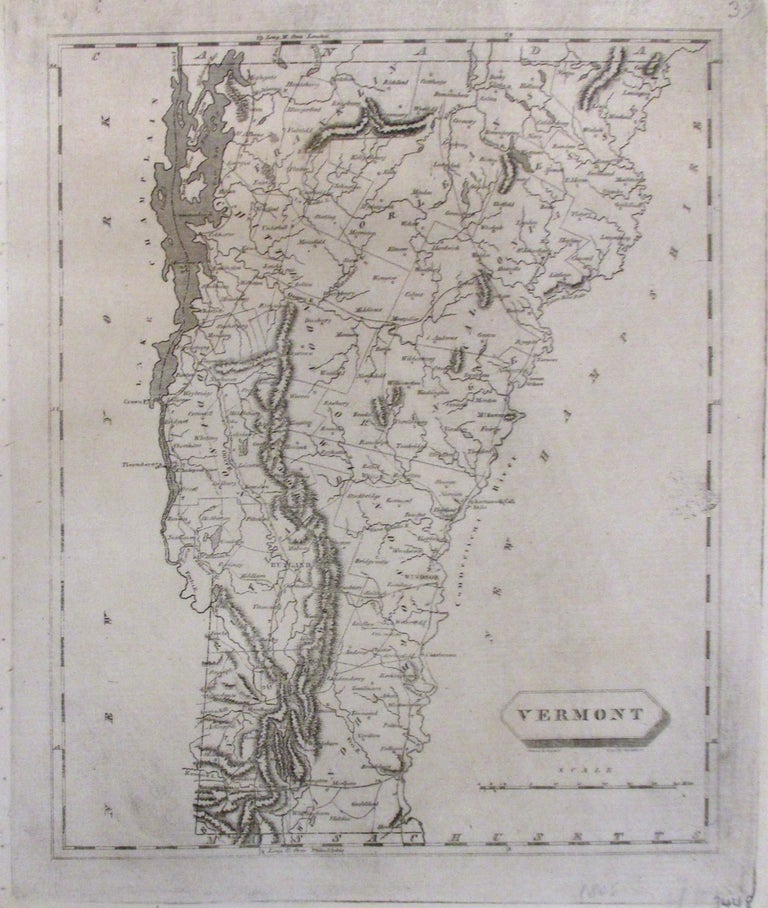
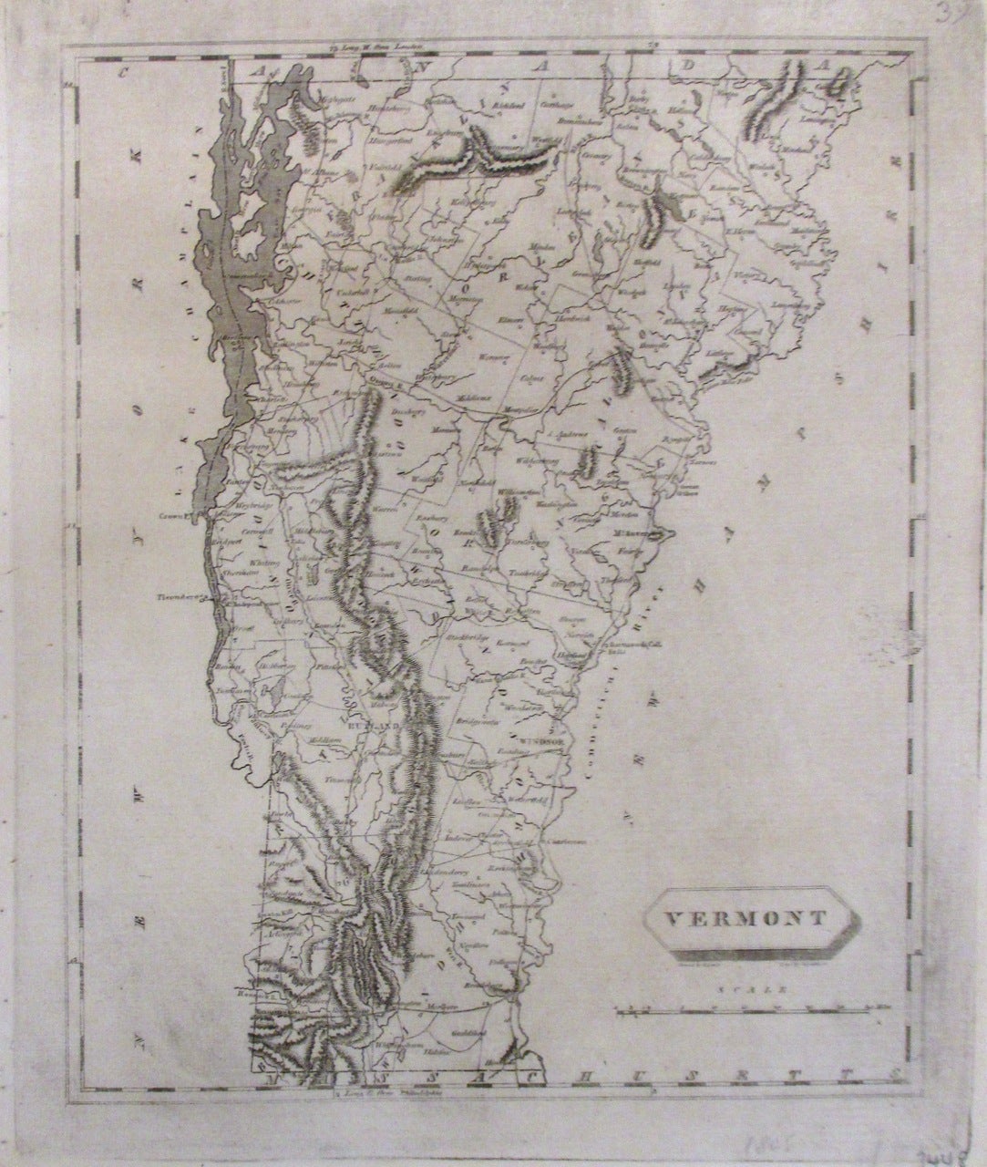
Vermont
Philadelphia: John Conrad & Co., 1805.
Map. Uncolored engraving. Image measures 9.75" x 8".
This map depicts the state of Vermont. The boundaries of Lake Champlain and the Connecticut River set the state off from the surrounding land, which is left unlabeled to isolate and highlight its detail. Denotes towns, counties and topographical features, all in beautiful detail. The map is in good condition with original platemark visible. Drawn by Samuel Lewis and engraved by D. Fairman. The map is from John Conrad & Co.'s "A new and elegant general atlas". The atlas was the first collaboration between Aaron Arrowsmith of London and Samuel Lewis of Philadelphia.
John Arrowsmith (1790-1873) was from a family of London based cartographers and publishers, and was a founding member of the Royal Geographical Society.
Samuel Lewis (c. 1754-1822), who drew this map, was a prolific geographer based in Philadelphia. This is a fine example of his work.
Binding: Unbound
Language: English
Price: $300.00
Item #263121