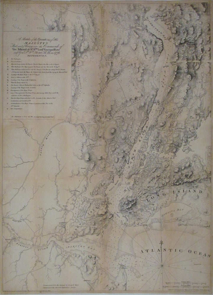
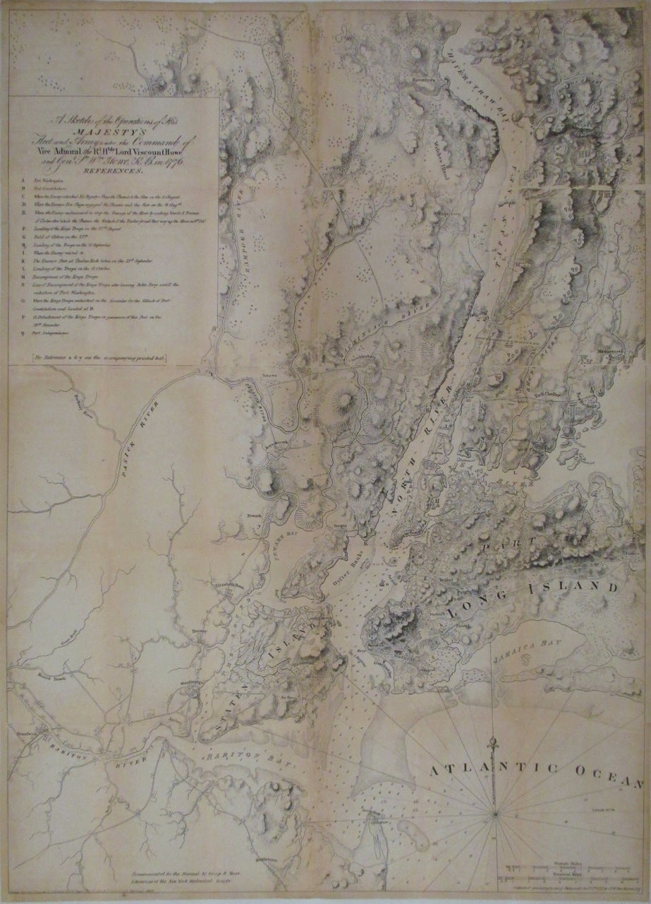
A Sketch of the Operations of His Majesty's Fleet and Army under the Command of Vice Admiral the Rt. Hble. Lord Viscount Howe and Genl. Sr. Wm. Howe, K.B., in 1776.
New York: D. T. Valentine, 1864.
Map. Uncolored. Mounted on linen. Image measures 35 7/8" x 22 3/4".
This important map shows the sites of the Revolutionary War battles in and around New York City. Extends from Sandy Hook in New Jersey north to Haverstraw and the Croton River and includes Staten Island, Manhattan, eastern New Jersey, Brooklyn and Queens. Highly detailed, the map features detailed topographical features, roads, coastal features, farms and buildings. It also details troop positions. Several warships are visible around New York City. A reference index in included below the title, noting important events including the final battle at Fort Washington. The map is mounted on linen and exhibits some chips and loss along the folds. Some toning along fold lines. The "Manuals of the Corporation" were directories of extensive historical and contemporary records of New York compiled by D.T. Much of the information was gleaned from Dutch and English sources, as processed by Valentine. D.T. Valentine (1801-1869) served as the Deputy to the Clerk of the Common Council for thirty-seven years without being promoted to Clerk. Valentine took it upon himself to compile the "Manuals", which he updated and published annually from 1841-1866. Many copies were personalized for prominent officials. This compendium is an excellent source of early New York City history.
Binding: Unbound
Language: English
Price: $650.00
Item #262750