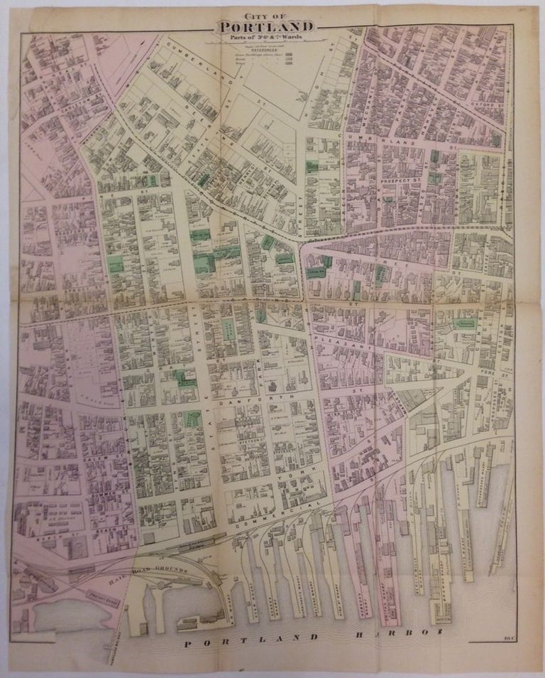
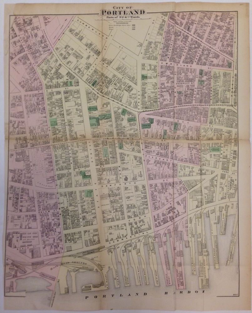
City of Portland, Parts of 5th, 6th, and 7th Wards
New York: Beers, F.W. & Co., 1871.
Map. Engraving with original hand coloring. Sheet measures 33.25" x 26.5".
Wonderful map of Portland, Maine from 1871, showing the Old Port district from Portland Harbor to Cumberland Street. Shows wharfs, waterways, bridges, railroads, streets, landowners and businesses. Light offsetting. Repair at top left margin. Frederick W. Beers (flourished 1858-1929) came from a family of surveyors, cartographers and publishers originally from Newtown Connecticut. F.W. Beers continued the work of his father James Botsford Beers and was known for his county survey maps of New York, Ohio, Pennsylvania, Michigan, Connecticut and Vermont.
Binding: Unbound
Language: English
Price: $250.00
Item #262290