
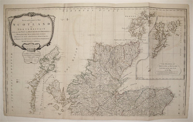
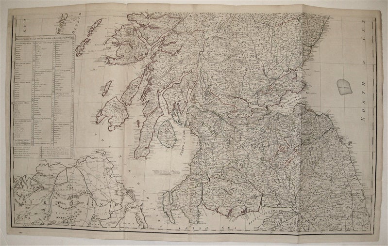
A New and Correct Map of Scotland or North Britain with all the Post and Military Roads, Divisions, &c
London: Sayer, 1790.
Map, in two sheets. Copper plate engraving with original outline hand color. Each image measures 24.25" x 21.25".
This large-scale wall map of Scotland depicts the country in intricate detail. Based on the work of Marcus Armstrong, this two-part map has a particular focus on military and post roads. Hand-colored lines divide and subdivide shires, mountains are depicted pictorially, and bodies of water such as lochs and firths are all labeled. At the upper right is a large inset of the "The Islands of Shetland or Zetland." The upper left corner contains a decorative title cartouche, and the map's lower left contains a key of "Distances of the Principal Stages on the Great Roads Leading from Edinburgh." The map is in very good condition with little edge wear. Minor offsetting throughout. Robert Sayer (1725-1794) was an important English publisher of maps, portraits, and nautical engravings. Partnering with John Bennett around the 1760s, the two published the works of well-known cartographers such as Kitchen, Jefferys, Belling, d'Anville and others. This beautiful, large-scale map is an impressive example of his work.
Binding: Unbound
Language: English
Price: $1,100.00
Item #234498