
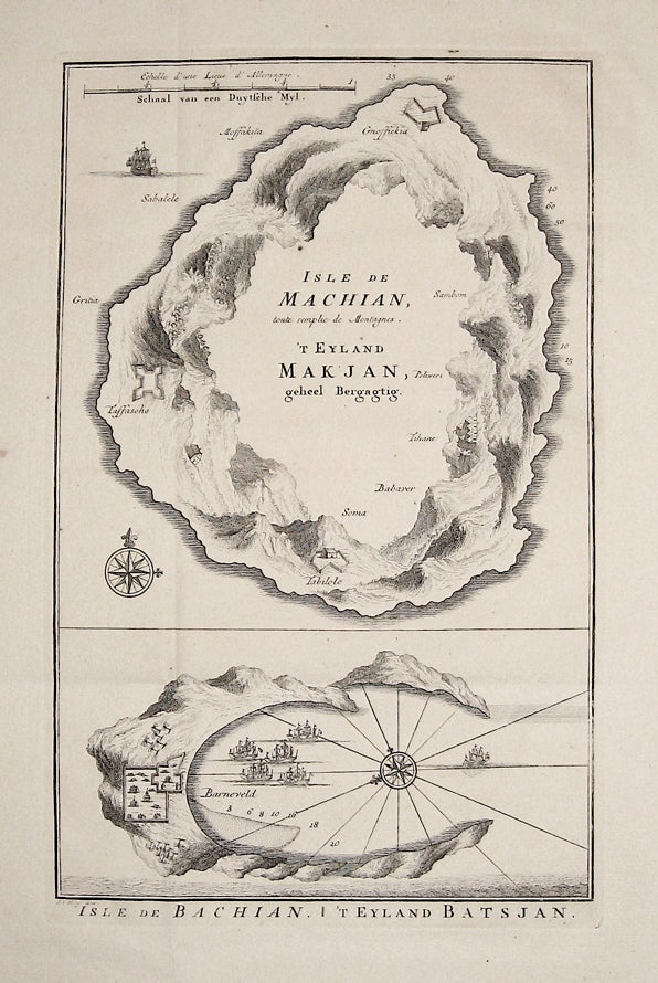
Isle de Machian, toute remplie de Montagnes./Isle de Bachian.
2 maps on 1 sheet. Engraving. Image measures 11.25 x 7".
These unusual aerial maps depict Machian and Bachian, now known as Makian and Bacan, located off the coast of Indonesia. These two islands were part of the historical "Spice Islands," which the Europeans and Chinese valued for their vegetation, particularly mace and nutmeg, and which belonged to the Dutch East Indies. Published circa 1756, these two maps emphasize the volcanic nature of the two islands, with the empty center of Machian referencing the destruction caused by the island's volcano in 1646. This emphasis is appropriate, as the volcano would erupt again in 1760. Fort Barneveld, which appears on Bachian, was a Dutch fort indicative of the country's colonial presence. Each map contains an ornamental compass and a number of illustrated ships. They are both dark impressions in good condition, with wide original margins and very minor foxing throughout. Jacques Nicolas Bellin (1703-1772) was the official hydrographer to the French king and the first person to hold the title of "Ingénieur de la Marine of the Depot des cartes et plans de la Marine" (chief engineer of the French Hydrographical Office). He was particularly well-known for his maps of the French Empire, especially the territories in North America. This map is a fine example of his detailed work.
Language: English
Price: $150.00
Item #234160