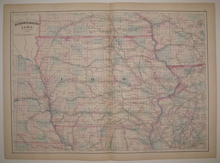
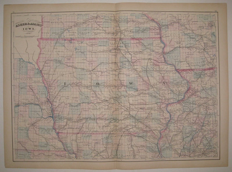
Asher & Adams' Iowa
New York: Asher & Adams, 1873.
Map. Engraving with original hand coloring. Image measures 15.75" x 22.25".
Classic double page map of Iowa with parts of Minnesota, Wisconsin, Illinois, Missouri and Nebraska. Shows counties, townships, towns, major routes, railroads and waterways. A clean copy in excellent condition. Asher & Adams were publishers based in Washington and New York in the late 19th century.
Binding: Unbound
Condition: Very Good(+)
Language: English
Price: $95.00
Item #222792