
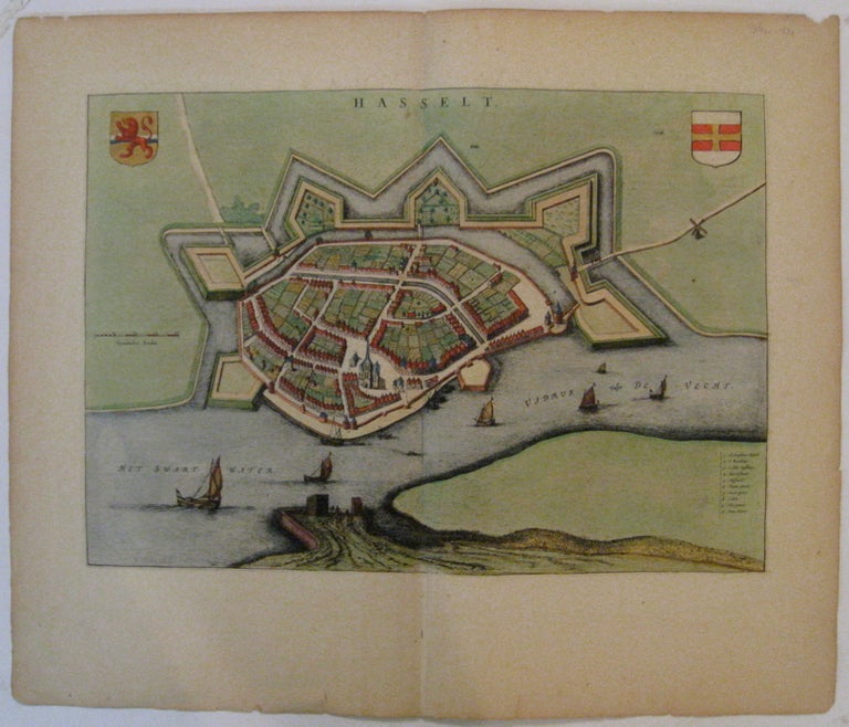
Hasselt.
Amsterdam.
Map. Engraving with original hand coloring. Image measures 13.75" x 19.75".
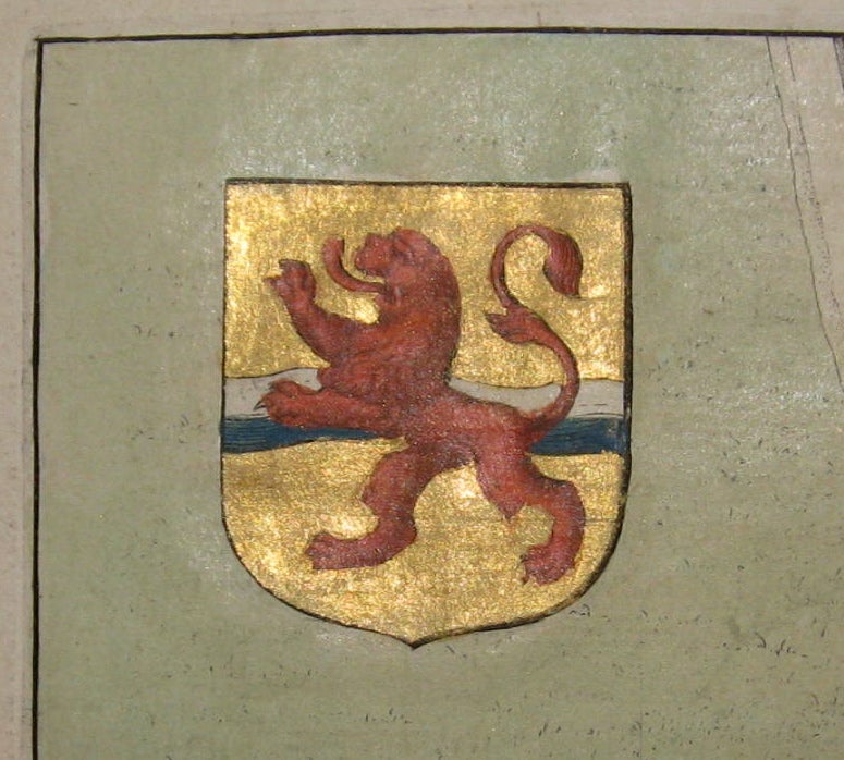
Absolutely stunning town plan of Hasselt in northeastern Holland, shown in an unusual panoramic birds-eye view, circa 1649. Features the fortress and the town within it, and ships in the surrounding river. Includes two coats of arms, both of which are hand burnished with beautiful gold leaf. Latin text on verso. Published around the time of the Spanish acknowledgment of the Dutch Republic in "Novum Ac Magnum Theatrum Urbium Belgicae Liberae Ac Foederataee" ("Town books of the Netherlands"). Many of the town plans included in this publication emphasized their strategic importance in response to the Spanish occupation. One of the most famous mapmakers of his time, Willem Blaeu (1571-1638) and his family worked out of Amsterdam. This series was published by his son Johannes (c. 1599-1673), who took over the business upon his father's death. Tears and chipping to edges.
Binding: Unbound
Condition: Very Good
Language: Latin
Price: $600.00
Item #208848