![Item #205470 Dovay; [Duacum, town of the Catuaci, most beautifully embellished by its appearance, its inhabitants and a university]. Georg BRAUN, Frans HOGENBERG.](https://argosybooks.cdn.bibliopolis.com/pictures/205470.jpg?width=768&height=1000&fit=bounds&auto=webp&v=1229704975)
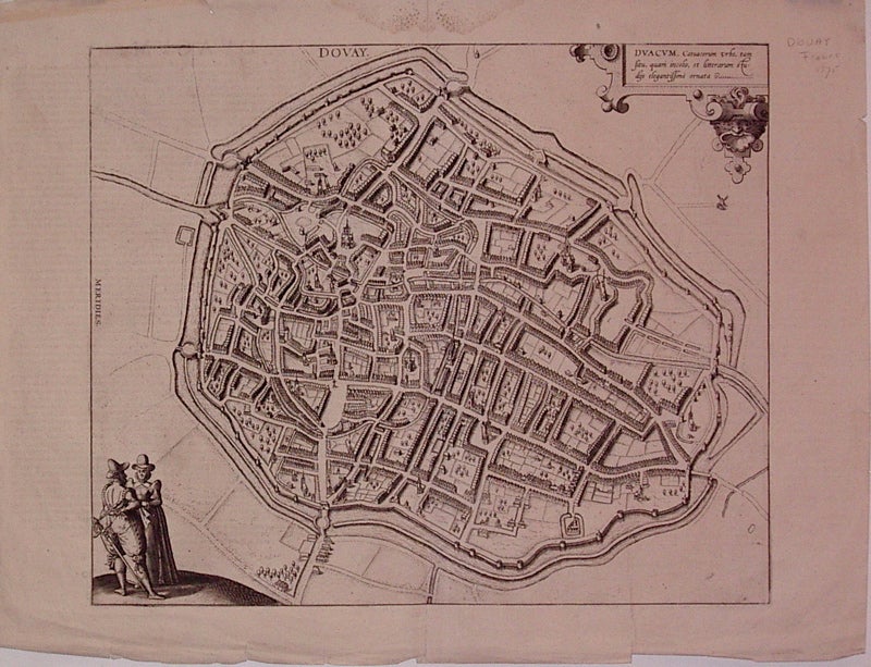
Dovay; [Duacum, town of the Catuaci, most beautifully embellished by its appearance, its inhabitants and a university]
Cologne: Braun & Hogenberg, 1575.
View. Uncolored engraving. Image measures 13" x 15.75".
Beautiful town plan of the fortified town of Douai in N. France. Douai, situated on the border of Flanders, Hainaut and Artois. From the city atlas "Civitates Orbis Terrarum", a collection of city views and plans created as a companion to Ortelius' "Theatrum Orbis Terrarum". The editions were published between 1572-1617. This edition has Latin text on verso. A few small tears and chipping to edges. Expert repairs to centerfold. Georg Braun (1541-1622) was a Catholic cleric who edited the "Civitates orbis terrarum," a collection of 546 prospects, bird's-eye views and maps of international cities. Hogenberg created the tables for the first 4 volumes. Together, these two geographers created a work that set new standard for cartography for the next century. This plan of Douai demonstrates the high quality of their work.
Binding: Unbound
Condition: Very Good
Language: English
Price: $200.00
Item #205470