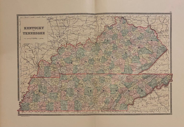
Kentucky and Tennessee
Philadelphia: Bradley, William M., 1888.
Map. Engraving with original hand coloring. Image measures 13.5" x 20.75".
Great double page map of Tennessee and Kentucky divided into counties. Shows towns, railroads, waterways and topographical details.
Binding: Unbound
Condition: Very Good(+)
Language: English
Price: $100.00
Item #203695
See all items by William M. BRADLEY