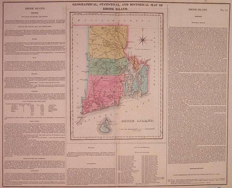
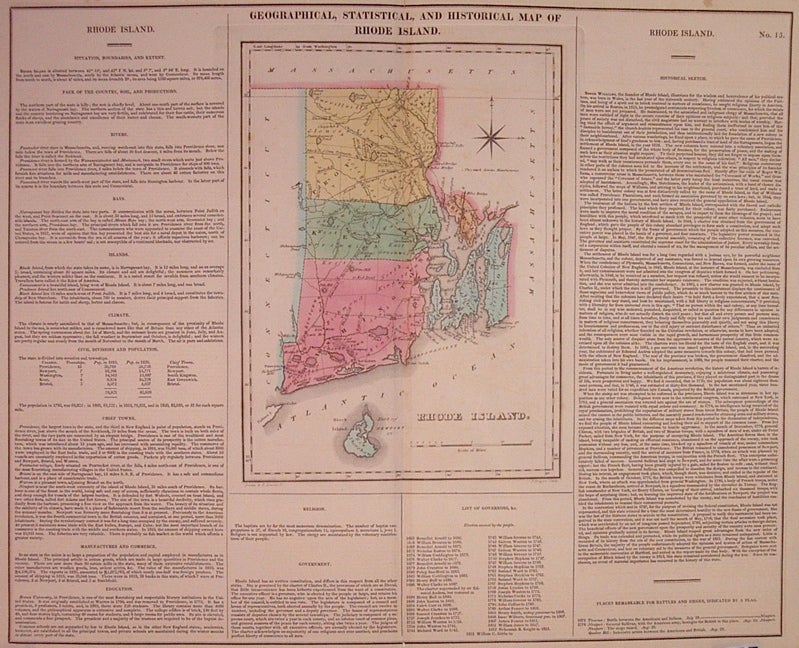
Geographical, Historical, and Statistical Map of Rhode Island
Philadelphia: Carey & Lea, 1822.
Map. Engraving with original hand coloring. Image measures 16.5" x 20.25". Page measures 17.5" x 21.75".
Great double page map of Rhode Island divided into counties. Shows towns, major routes and waterways. Includes information pertaining to history, climate and culture. Light scattered foxing to margins, and slight toning along centerfold. From "A Complete Historical, Chronological, and Geographical American Atlas..." of 1822.
The Philadelphia-based firm of Carey & Lea of Philadelphia was one of the most important publishers in the early 19th-century United States. Run by Mathew Carey (1760-1839) and Isaac Lea (1792-1886), the company worked with both books and maps, specializing particularly in political commentary. Their "Complete Historical, Chronological, and Geographical American Atlas," first published in 1822, contained some of the earliest maps of western states being admitted to the Union, accompanied by extension information about those states. As a result, their maps provides an invaluable window into the country's history.
Binding: Unbound
Condition: Very Good(+)
Language: English
Price: $300.00
Item #203675