
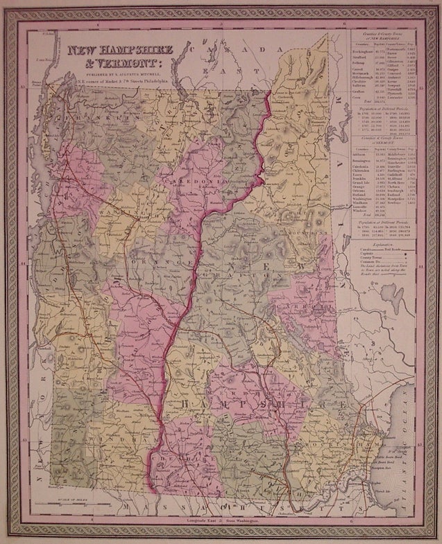
New Hampshire & Vermont:
Philadelphia: Mitchell, Samuel Augustus, 1850.
Map. Engraving and lithograph with original hand coloring. Image measures 15" x 12".
Classic map of New Hampshire and Vermont divided into counties. Details towns, major routes, railroad, waterways and topography. A table at right lists populations of individual counties and towns. Small chip to lower right corner.
Samuel Augustus Mitchell Sr. (1792-1868) was one of the leaders in American cartography of the 19th century and pioneered the conversion of engraved map plates to more affordable lithographic plates. His son, Samuel Augustus Mitchell Jr. continued his father's successful mapmaking and publishing business, and was one of the most prolific and renowned 19th century American publishers.
Binding: Unbound
Condition: Very Good(+)
Language: English
Price: $125.00
Item #203546