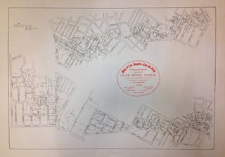
Map of Los Angeles City Oil Field
San Francisco: State Mining Bureau. Map. Uncolored lithograph. Image measures 16.5" x 24". This hard to find late 19th c map of the Los Angeles city oil fields was issued by the State Mining Bureau. The map covers most of the modern West Lake neighborhood and vicinity and depicts the region in two sections and shows the oil fields throughout the city. The first extending from Vermont Avenue and Sixth Street to Lake Shore Boulevard and Brent Street, while the..... More