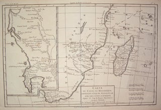
Carte du Canal de Mosambique, Contentant L'Isle de Madagascar avec Les Cotes D'Afrique, depuis le Cap de Bonne Esperance, jusqu'a Melinde.
Paris: Bonne, Rigobert, 1788. Map. Uncolored copper plate engraving. Image measures 8.25" x 12.5". Part of the Atlas Maritime, this map of Mozambique includes an inset of South Africa from Cape Colony to St. Helens Bay as well as Madagascar. More