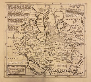
Carte Moderne de La Perse, Hors La Partie La Partie La Plus Occidentale de ce Royaume
Paris: Rigobert Bonne, 1780. Map. Image measures 13 1/4" x 8 3/4" This map printed 1780 depicts the eastern extent of Persia, extending from the Persian Gulf and the Caspian Sea to the Indus River. Pictorial elevations rendered throughout as well as town names, rivers and lakes. The map is in very good condition with full margins. Rigobert Bonne (1727-1795) was one of the most important cartographers of the late 18th century. He served as Hydrographer to France, and during..... More