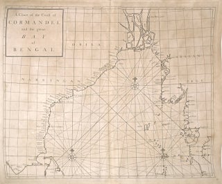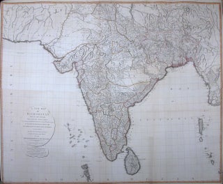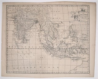
An Accurate Map of the East Indies Exhibiting the Course of the European Trade both on the Continent and Islands
London: Bowen, Emanuel. Map. Uncolored Engraving. Image measures 14 1/2" x 17 3/4". This elaborate map of the East Indies extends from Australia, the Philippines and the Carolines in the east to India, the Malvdives and Afganistan in the West. The index includes towns and geographic features such as mountains, rivers, and islands. In addition, the map also features information about trade winds in the Indian Ocean and South China Sea. The coast of early Australia, labeled here as New..... More