The Hudson River Today and Yesterday
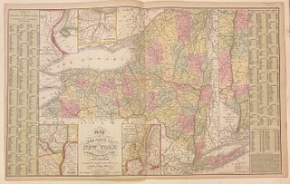
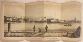
New York: Historian Publishing Co., 1915. Profusely illustrated with black and white photographs, includes fold-out map. 85 pages. 12mo, blue pictorial cloth (lightly worn at extremities, some minor staining including faint ring on cover). New York: Historian Publishing Co., (1915). A very good copy. More