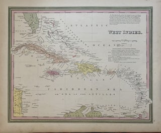
West Indies
Philadelphia: H. N. Burroughs, 1846. Map. Lithograph with original hand coloring. Image measures 15.75" x 12.5". This map of the West Indies extends from the southern tip of Florida to the northern coast of South America, and from the western tip of Cuba to Barbados in the east. The index includes capitals, cities, and towns, labeled in a stylized manner that complements the region's scattered arrangement of islands. Above the title is a paragraph describing the region and its constituent..... More