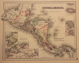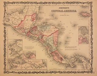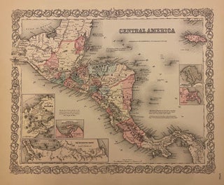
Central America
New York: J.H. Colton & Co., 1856. Map. Engraving with original hand coloring. Image measures 14 3/4" x 18 1/8". Decorative and informative map of Central America. Features several insets depicting the Isthmus of Panama, the "Nicaragua Route", and the harbor of San Juan de Nicaragua, as well as grid plans of the City of Panama, and Aspinwall City on the island of Manzanilla. Extensively labeled with cities, coastal features and islands, major rivers, regions, and native populations. The Panama..... More