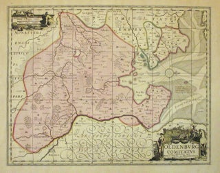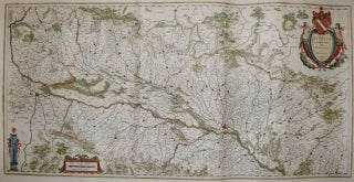
Alsatia Landgraviatus, cum Suntgoia et Brisgoia
Amsterdam. Map. Copperplate engraving with hand coloring. Image measures 15.5 x 31". Sheet measures 22 x 33". This map of the historic French region of Alsace focuses on the lower Rhine River. Oriented with north to the right, the map describes a fertile area of France that, due to the many tributaries of the river, has historically been well-known for its wine. Perhaps the lushness of the region can account for the map's, particularly risqué title cartouche, which features two..... More

![Item #239576 [Sundial Projection World Map]. Franz RITTER](https://argosybooks.cdn.bibliopolis.com/pictures/239576.jpg?width=320&height=427&fit=bounds&auto=webp&v=1360259001)