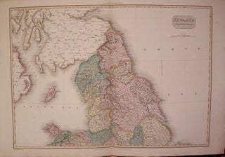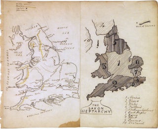
The Saxon Heptarchy. England and Wales
Map. Pen and ink with watercolor. Sheet measures 7 x 8.5". This beautiful schoolgirl or schoolboy manuscript map of England and Wales beautifully depicts from Scotland south to the English Channel. Essentially two maps on a single sheet, the left map depicts the region with detailed topography throughout. Towns, rivers and mountains are noted with a key in the top left corner. The right hand side of the map depicts "The Saxon Heptarchy" and territories are numbered and shaded in..... More

![Item #310691 Cambriae Typus Auctore Humfredo Lhuydo; [Map of Wales by Humphrey Lhuyd]. Abraham...](https://argosybooks.cdn.bibliopolis.com/pictures/310691.jpg?width=320&height=427&fit=bounds&auto=webp&v=1666211556)