A New Map of the Circle of Austria
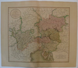
London: John Cary, 1811. Map. Engraving with hand coloring. Image measures 17.75" x 20.25". Detailed map of the Austrian Empire. Overall toning, full original margins. More
London: John Cary, 1811. Map. Engraving with hand coloring. Image measures 17.75" x 20.25". Detailed map of the Austrian Empire. Overall toning, full original margins. More
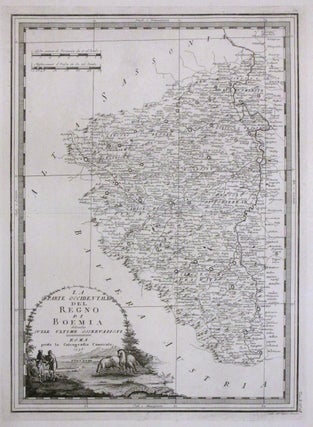
Rome: G. M. Cassini, 1776. Map. Uncolored engraving. Image measures 18.75" x 13.75". This fine antique map of the western part of Bohemia (modern day Czech Republic) extends westward from Prague. Details roads, towns and pictorial topography. Depicts Bohemia while it was in the midst of the Czech National Revival. A ornate title cartouche featuring a pastoral scene adorns the lower left corner. Map is in very good condition with slight wear along the centerfold. This map is from the..... More
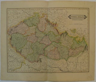
Edinburgh: Lizars, D., 1828. Map. Engraving with original hand coloring. Image measures 15" x 19.25". Nicely detailed map of Bohemia and Moravia. Minor wear to full original margins. More
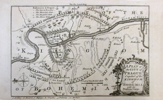
London: The London Magazine, 1757. Miniature map. Uncolored engraving. Image measures 4.75" x 6.75". This unusual plan of Prague was published by The London Magazine just a few months following the 1757 Battle of Prague. Oriented with north facing left, it depicts the position of the two armies with a key in the bottom margin locating the positions of the artillery, reserves, batteries and mortars of the Prussian Army on the map. The Battle of Prague, part of the Seven..... More
You guys don’t waste time! Thank you so much for Leoncavallo! He is now in my study, on the wall of honour. You may have read that things are grim here in Melbourne, with everything in hard lockdown and everyone confined to their homes for at least six weeks. This has brought me real joy and I cannot thank you all enough. Best wishes
Hello. I think that you will like to know that the Robert Frank's book came today in perfect conditions. You get my congratulations for so fast shipping. Best regards.