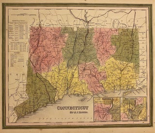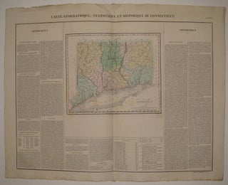
Carte Geographique, Statistique et Historique du Connecticut.
Paris: Buchon, Jean Alexandre, 1825. Map. Engraving with original hand coloring. Image measures 9.5" x 11 3/8", image plus text and title measures 19" x 24". Nicely detailed map of Connecticut divided into counties and townships. Includes historical and cultural information in French. Minor toning to edges, crease to top center. Light scattered staining. From the French (1825) edition of Carey and Lea's 1822 "A Complete Historical, Chronological, and Geographical American Atlas" More