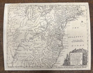
A Map of the British American Plantations extending from Boston in New England to Georgia; including all the back Settlements
London: Gentleman's Magazine, 1754. Map. Engraving. Measures 8 3/4 x 11 inches. Fascinating map of English and French forts in the Colonies during the French Indian war. Many Indigenous names are included. Strange boundaries extend west and north in the colonies, revealing the disputes over land with the French. Strange cartouche with a mans head in a bush with an arrow in it. Mounted on linen and margins cropped but otherwise in good condition. The Gentleman's Magazine, founded by Edward..... More