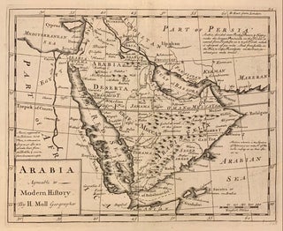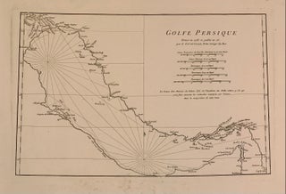
Golfe Persique Dresse en 1758 et publie en 76
1776. Sea chart. Engraving. Trapezoid projection, image 11 x 16 3/4 inches (lower widens to 17 1/4"), sheet measures 16 1/2 x 22 inches. Fine map of the Gulf with many toponyms along the coast such as Deh Rogn (Qatar) and Zaka (UAE). Jean Baptiste Bourguignon d' Anville (1697-1782) was a French geographer and cartographer whose accurate, research-based work raised the standards for 18th-century map-making. Passionate about maps from his childhood, he created maps during his school years and would..... More