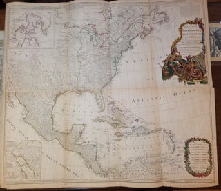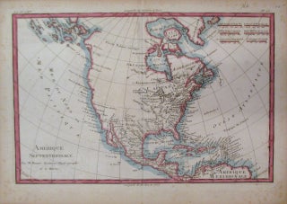
Amerique Septentrionale
Paris: 1780. Map. Engraving with original outline coloring. Image measures 8 1/4" x 12 1/2". Early edition of Bonne's North America, with the name Canada prominently featured in the center of the Great Lakes. Shows the continent in the midst of the American Revolutionary War. The Pacific Ocean is labeled as both the Pacific and the North Sea. Map is in good condition with some toning along centerfold. Some spotting along margins but otherwise good example. Rigobert Bonne (1727-1795) was..... More