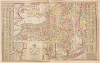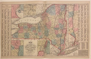
Map of the State of New York compiled from the latest authorities
Philadelphia: Desilver, Charles, 1857. Map. Engraving with original hand coloring. Image measures 16" x 26 1/8" Nice clear map of New York divided into counties. Shows towns, major routes, railroads, waterways, and topographical features. Insets include the vicinities of Albany, New York City, Rochester, and Niagara Falls, and a Map of the Hudson River from New York to Albany. On either side of the map is a table listing populations of counties and townships, square miles of counties, and other..... More