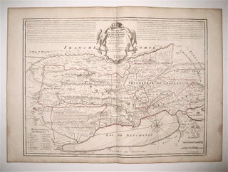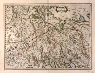
Zurichgow et Basiliensis provincia
Amsterdam. Map. Engraving with hand coloring. Image measures 15" x 19.75". This striking circa 1640 map by Willem Blaeu depicts the regions of Zurich and vicinity, Switzerland. The map covers northern Switzerland and extends from Mullhouse to the Obersee. The important towns of Basel, Lucerne, Zurich, Argow, and several others are noted in profile. The map also labels lakes, rivers and other topographic features with beautifully rendered mountains and forests. Latin text on verso provides interesting history and description of..... More