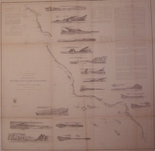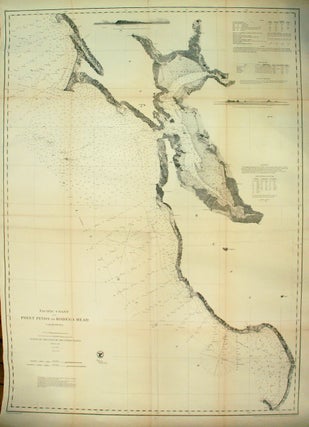
Pacific Coast from Point Pinos to Bodega Head California; San Francisco Bay Area
Washington: Government Printing Office, 1866. Map. Uncolored lithograph. Sheet measures 41.75" x 30.5". This exceptional sea chart issued by the United States Coast Survey in 1866 beautifully depicts the San Francisco Bay. The chart extends from Point Pinos and Monterey Bay northward to Bodega Bay and includes the whole of San Francisco Bay and San Pablo Bay. Offers inland detail along the coast and details the city of San Francisco. Oakland, Napa, Petaluma, Brooklyn, Union City, Vallejo, Redwood City, Alviso..... More