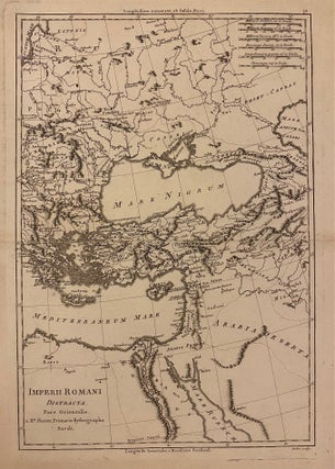
A General Map of the Roman Empire shewing the situation of all it's Provinces & seats of ye Barbarous Nations on their Frontiers
1747. Map. Sheet measures 20.25" x 10.5". Shows some foxing. In good condition. This is a beautiful circa 1747 map of the Roman Empire engraved by J. Blundell and published in "An Universal History from the Earliest Account of the Time to the Present", vol vii. Centered on the Black Sea, the map depicts the extent of the Empire through Europe, northern Africa, and the Middle East. Mountains and forests are beautifully depicted throughout with important cities and regions identified..... More