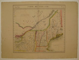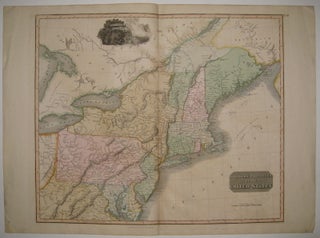
Northern Provinces of the United States
1817. Map. Engraving with original hand outline color. Image measures 19.5" x 23.25". Nicely detailed double page map of the northeastern coast of America, from Maine (the District of Main) to parts of Virginia and Maryland. Shows topographical features, forts, towns and waterways. Includes a beautiful view of Niagara Falls. Published in Thomson's "New General Atlas". Minor overall offsetting. John Thomson (1777 - 1837) was a Scottish bookseller and publisher active in the early 19th century, who was one of..... More