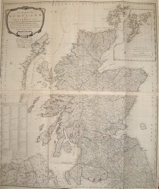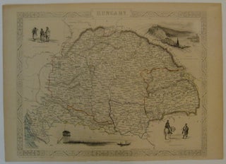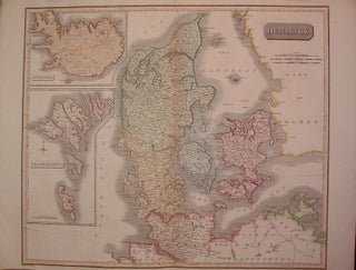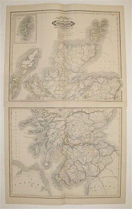
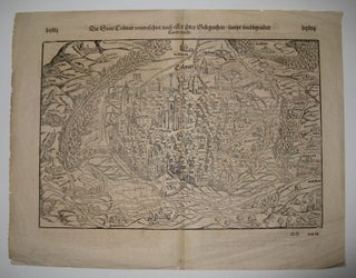
New Road Map of Scotland With All The Lines of Railway, Canals &c &c
Edinburgh: Lizars, William, 1831. Map in two sheets. Lithograph with original hand outline. Each image measures 16.5" x 20.5". This map of Scotland emphasizes the country's developing transportation in the early 19th century, particularly roads, railroads, and canals. Cities, towns, roads, and rivers are labeled, counties are outlined with colored borders, and relief is shown with hachures. An inset in the top left shows the Shetland Islands. Below the title is a key listing built and proposed railroads, and annotations..... More
![Item #243962 [Case of Large School Maps]. RAND MCNALLY, CO](https://argosybooks.cdn.bibliopolis.com/pictures/243962.jpg?width=320&height=427&fit=bounds&auto=webp&v=1375459883)
![Item #272805 [Lemnos. Hellespont]. George SANDYS](https://argosybooks.cdn.bibliopolis.com/pictures/272805.jpg?width=320&height=427&fit=bounds&auto=webp&v=1485291158)