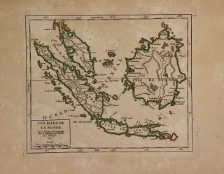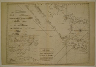
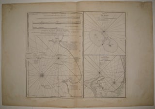
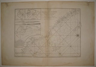
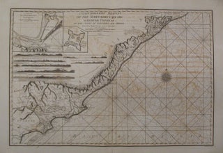
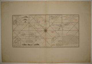
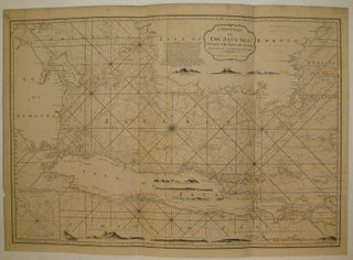
A Chart of the South Part of Sumatra and of the Straits of Sunda and Banca with Gaspar Straits...
London: Laurie & Whittle, 1799. Sea chart. Uncolored copper plate engraving. Image measures 24" x 32.5". Stunning chart of the southern tip of Sumatra, with the Strait of Sunda and part of Java and the Java Sea. Includes rhumb lines, depths, shoals, a compass rose and an inset map: "A Particular Chart of the Straits of Sunda." The coast lines are further illustrated with with many topographical cross sections. Published in "The East-India Pilot, or Oriental Navigator, on One Hundred..... More


![Item #273380 [Southeast Asia]; Rare 1725 Map of East Indies and South East Asia. RENNEVILLE](https://argosybooks.cdn.bibliopolis.com/pictures/273380.jpg?width=320&height=427&fit=bounds&auto=webp&v=1487284208)