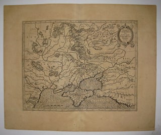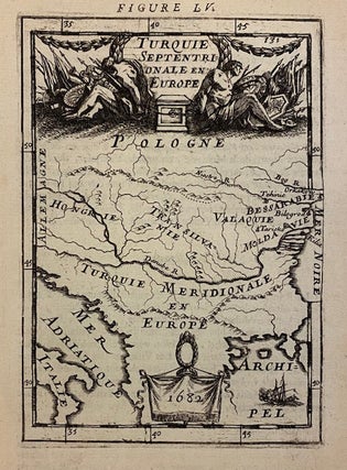
Turquie Septentrionale en Europe
Paris: Denys Thierry, 1682. Miniature map. Copper plate engraving with hand coloring. Image measures 5 3/4" x 4". Sheet measures 6 1/4" x 5 3/8". Paris: Denys Thierry, (1682). This lovely miniature map of the Balkans is from the original French edition of Manesson-Mallet's "Description de L'Univers." The map depicts the region between the Adriatic and the Black Sea, with the Danube River transecting the map. Poland, Hungary, Transylvania, Moldova, Wallachia, and Bessarabia are labeled. Mountains are rendered pictorially. A...... More