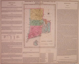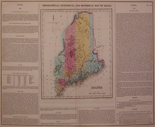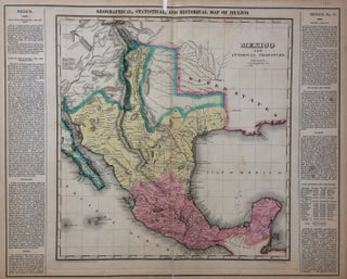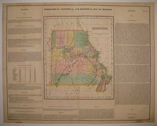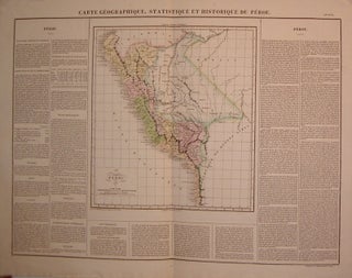
Carte Geographique, Statistique et Historique du Perou.
Paris: Buchon, Jean Alexandre, 1825. Map. Engraving with original hand coloring. Image measures 13.5" x 12.25", image plus text measures 18.5" x 24.5". Includes historical and cultural information in French. Some wear along edges. From the French (1825) edition of Carey and Lea's 1822 "A Complete Historical, Chronological, and Geographical American Atlas" More