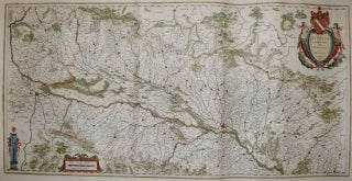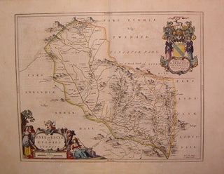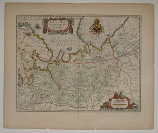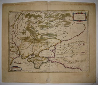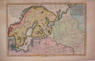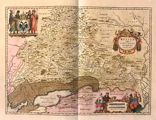
Russiae, vulgo Moscovia, Pars Australis
Amsterdam: Johannes Blaeu. Map. Copper plate engraving with original hand coloring with highlights in gold. Image measures 15.25" x 21". This beautiful circa 1650 map by Johannes Blaeu depicts southern Russia in detail. Covering the southwest part of Russia and Eastern Ukraine, the map extends from Vologda south to the Sea of Azov and from Mykolaiv east to the Volga River, where it discharges into the Caspian Sea. Throughout, the map notes rivers, towns, cities, lakes, and a host of..... More