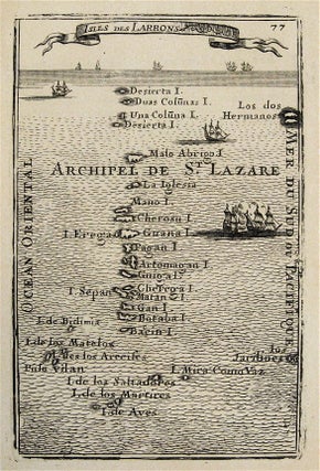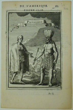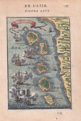
Isle Molucoves
Paris: Denys Thierry, 1683. Miniature view. Copper plate engraving with hand coloring. Sheet measures 8" x 5.25". This miniature map by Allain Manesson-Mallet dates to 1683 and depicts the Moluccas, part of the so-called Spice Islands, otherwise known as the Maluku Islands, in Indonesia. The map covers the Islands in North Maluku from Pulau Hiri and Ternate to Bacan. Various vessels fill the expanse of water around the islands, seemingly engaged in naval warfare. Trees, hills, and fortifications are noted..... More