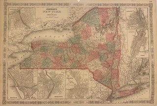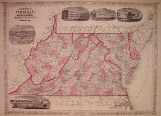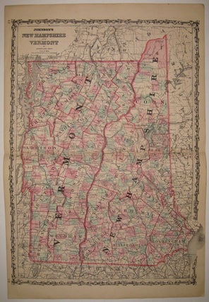
Johnson's New Hampshire and Vermont
New York: Johnson & Ward, 1862. Map. Engraving with original hand coloring. Image measures 24" x 17.5". Bold double page map of New Hampshire and Vermont divided into counties and townships. Delineates towns, waterways, railroads and major routes. In excellent condition with light creasing to upper left and light scattered foxing to margins. Alvin Jewett Johnson (1827-1884) is one of the most prolific American publishers of the 19th century. He opened his own company in 1856 that produced atlases, maps..... More