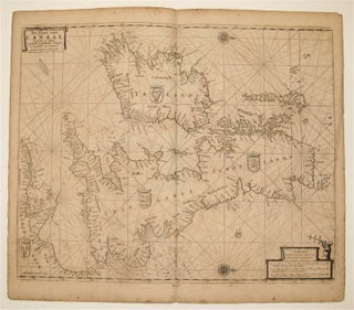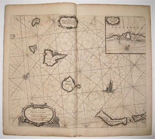
Caarte voor een gedeelte der Canarise Eylanden
Amsterdam: Jacques & Gasper Anthoine, 1669. Sea chart. Uncolored copperplate engraving. Image measures 17 1/4" x 21 1/4". This rare sea chart by Pieter Goos shows the Spanish territory of the Canary Islands off the coast of northwest Africa. It encompasses, from left to right, El Hierro, La Palma, La Gomera, Tenerife, Gran Canaria, Fuerteventura, Isla de Lobos, Lanzarote, La Graciosa, Montaña Clara, and Alegranza. In addition to ports, the map includes soundings, sand bars, fishing banks and navigational hazards..... More