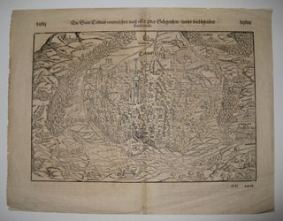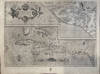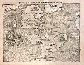
Die neuwen inseln so hinder Hispanien gegen Orient bey dem Land Indie ligen
Basel: Heinrich Petri, 1572. Map. Uncolored woodcut. Sheet measures 12" x 15.25". This important and influential 1572 map by Sebastian Munster is the first map to show North America and South America in their true continental forms. It is also significant in that it names the Pacific Ocean (Mare Pacificum) and the first printed map to ever show Japan (Zipangri), here appearing based on the accounts of Marco Polo. First published in 1544 in his Basel edition of Ptolemy's "Geographia"..... More