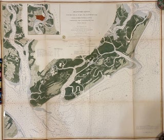
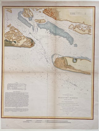
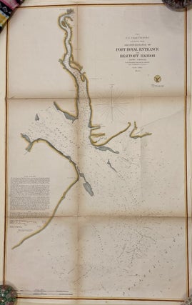
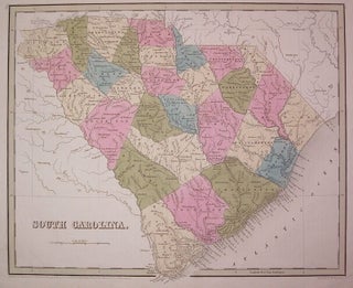
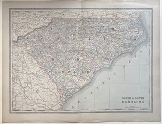
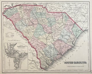
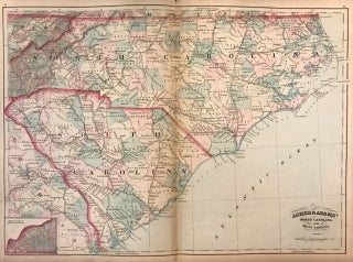
South Carolina Colonial Land Policies
Columbia: University of South Carolina Press, 1977. 8vo, original blue boards, ex-lib, otherwise very good. Columbia: University of South Carolina Press, (1977). More
Cokesbury, SC: 1878. Large signature on a 5.5" x 2.5" autograph page, as a newly elected member of the United States House of Representatives: "D. Wyatt Aiken - Cokesbury - South Carolina Mach 11th 1878" . Fine condition. South Carolina secessionist who, as a Colonel, led a regiment of the 7th South Carolina Infantry in the Peninsula and Northern Virginia Campaigns; and was severely wounded by a shot through the lungs at the Battle of Antietam in September 1862. After..... More
New York: Harper, 1930. Illus. 425pp. 8vo, brown cloth. New York: Harper, 1930. First Edition. Very good. More
New York: Asher & Adams, 1873. Map. Lithograph original hand coloring. Image measures 16 x 22.5". This 1873 map depicts the states of North Carolina and South Carolina with special focus on the developing railway systems of the two states. An inset in the bottom left features the western portion of North Carolina. Counties are hand colored and railway lines are labeled. City and town names occur as well as stops along the routes. Rivers, capes, islands and other topographic..... More
1856. Sea chart. Uncolored lithograph. Image measures 30.75" x 32". Fantastically detailed sea chart of Charleston Harbor from Folly Island to the Cooper and Wando Rivers, from Sullivan Island and up the coast past Breach Inlet. Streets are clearly laid out in Charleston, Mount Pleasant and Moultrieville. Includes topographical elements, forts, sandbars, waterways, depths, sailing directions and tidal information. Inset views include "Main Ship Channel" and "North Channel, Fort Sumter". Alexander Dallas Bache (1806-1867) was an incredibly prolific surveyor, who..... More
1853. Map. Engraving with hand coloring. Image measures 16.75" x 13.5". Nice sea chart of the central west South Carolina. Includes depths, tidal information, buoy locations and sailing directions. In excellent condition, with minor toning along original folds. Alexander Dallas Bache (1806-1867) was an incredibly prolific surveyor, who worked as the superintendent of the United States Coast Survey. More
8vo, cloth, d.w.; (d.w. lightly soiled, otherwise very good). Univ. of North Carolina Press, 1956. More
Pelzer: The Berry-Gaines-Harrison Reunion, 1956. Illustrated. vii + 106 pages, thin 8vo, printed red wrappers; a few spots of minor wear, few instances of notes in the margins. Pelzer, South Carolina: The Berry-Gaines-Harrison Reunion, 1956. A very good copy. More
New York: Oxford University Press, 1981. Illustrated. xxii + 421 pages, 8vo, cloth, d.w.; dust wrapper lightly worn. New York: Oxford University Press, 1981. A very good(+) copy in a very good dust wrapper. More
Boston: Lee and Shepard, 1893. 286pp. + 2pp. of publisher's ads. 12mo, blue cloth, cloth lightly soiled, small area of browning on four pages, last blank page lightly dampstained, small areas of chipping to margin of one page. Boston: Lee and Shepard, 1893. First Edition. Author's experiences as a teacher of ex-slaves in Beaufort, South Carolina from 1864 to 1865. She was an abolitionist from the North. More
Boston: Bradford, Thomas Gamaliel, 1836. Map. Engraving with original hand outline coloring. Image measures 7.75" x 10". Nice map of Georgia and the Carolinas divided into counties. Shows towns, major routes, waterways and railroads. Light scattered foxing. T.G. Bradford (1802-1887) was a Boston based publisher. He worked as assistant editor of the American Encyclopedia before entering the field of map making. More
Boston: Bradford, Thomas Gamaliel, 1838. Map. Engraving with original hand outline coloring. Image measures 11.5" x 14.25". Beautiful map of South Carolina divided into counties. Shows towns and waterways. In very good conditon with light foxing to outer margins and faint creasing. T.G. Bradford (1802-1887) was a Boston based publisher. He worked as assistant editor of the American Encyclopedia before entering the field of map making. More
Charleston: Charleston Museum, 1955. 149 black and white illustrations, 150pp., Sm. 4to, rust cloth. Charleston: The Charleston Museum, 1955. Vry good. Furniture in the Charleston Museum. More
Charleston: Charleston Museum, 1968. Black & white illustrations. 8vo, blue cloth spine, grey boards, d.w. Charleston: Charleston Museum, 1968. Fine. Contributions from The Charleston Museum, X. More
Philadelphia: Carey & Lea, 1822. Map. Engraving with original hand coloring. Image measures 12.75" x 14.75", image plus text measures 16.25" x 20.75". Beautiful double page map of South Carolina divided into counties. Towns, states, waterways and topographical details shown in immense detail. Extensive information pertaining to history, climate and culture surrounds map. From "A Complete Historical, Chronological, and Geographical American Atlas...". Very light offsetting, small tear to right edge. Small stain to upper right. More
Philadelphia: Carey & Lea, 1822. Map. Engraving with original hand coloring. Image measures 10.75" x 10.5", image plus text measures 16.5" x 20 5/8". Beautiful double page map of Washington D.C. and its environs, including Alexandria. Shows street plan, major roads, waterways, marshlands and topography. Extensive information pertaining to history, climate and culture surrounds map. From "A Complete Historical, Chronological, and Geographical American Atlas...". Crease to upper right, light spots of foxing to top margin. Expert repair to centerfold... More
color Frontis., numerous b/w illus. tall 4to, cloth, d.w. chipped. N.Y., (1956). More
Boston: Houghton Mifflin, 1949. Ed. by Ben Ames Williams. 572pp. 8vo, green cloth, spine and edges of corners lightly worn, many pages creases in upper right corner margins. Boston: Houghton Mifflin, (1949). More
Chester: Chester County SC Historical Society, 2000. Illus. 2 Vols. 4to, blue boards. (Volume I): Chester: Chester County, SC Historical Society, 2000. Fine Sold with Volume II: Heritage History of Chester County, South Carolina. Dallas: Taylor Publishing, 1995. This volume has the name of a previous owner in gilt on the front cover. Both volumes are mostly short biographies with genealogy information of county residents along with some portraits. More
Shippensburg: White Mane, 1991. illus. 8vo, cloth, d.w. (Shippensburg): White Mane Publishing, (1991). Fine. More
New York: Samuel Gaston, 1857. Map. Engraving with original hand coloring. Image measures 5.5 x 6.5". This map shows the state of South Carolina in the middle of the 19th century. Published in 1857, it predates by only three years the state's declaration of its secession from the Union in 1860, the unofficial start of the Civil War. The state's counties are hand-colored, and cities, rivers, and railroads are all labeled. An inset in the lower left shows the Charleston..... More
New York: J.H. Colton & Co., 1855. Map. Engraving with original hand coloring. Image measures 14" x 17.5". Shows some small tears In very good condition. A Railroad map of South Carolina showing counties and seats, canals, and railroad depots. Inset shows pan of Charleston vicinity and harbor. The Colton family was one the most prolific and successful publishers of maps and atlases in the United States. J.H. Colton (1800-1893) founded his business in NYC in 1831... More
Chicago: George F. Cram & Co., 1874. Map. Color lithograph. Image measures 13.75" x 20.5". This nice map by George F. Cram depicts the states of North Carolina and South Carolina was published in 1874. Color coded by counties, the map notes railroads, cities, towns, rivers, and other topographical features. Verso features a map of Georgia and Mississippi. In good condition with minor wear along the original centerfold and some wear near edges, can be repaired. After serving in the..... More
8vo, boards. Columbia: Univ. of South Carolina Press, (1977). More
Frontis. 8vo, cloth, d.w.; (d.w. lightly soiled, otherwise very good). Univ. of New Mexico Press, (1962). More
Dear Sir, For three days I received Reynard the Fox (goethe, Arnold). The package was in good order and the book in perfect health. It fits very well my Reynard (and fable) collection. Thanks.
The book arrived here in Australia in excellent condition, well packaged within a very short timeframe. The postage service that you provided through DHL was very much appreciated as it enabled me to keep track of the location of the package and monitor delivery time. The whole transaction from my first enquiry, to you providing photos of the book to delivery has been an enjoyable experience without any hassles. Thank you very much for your time and effort and I hope you have an enjoyable holiday season.