
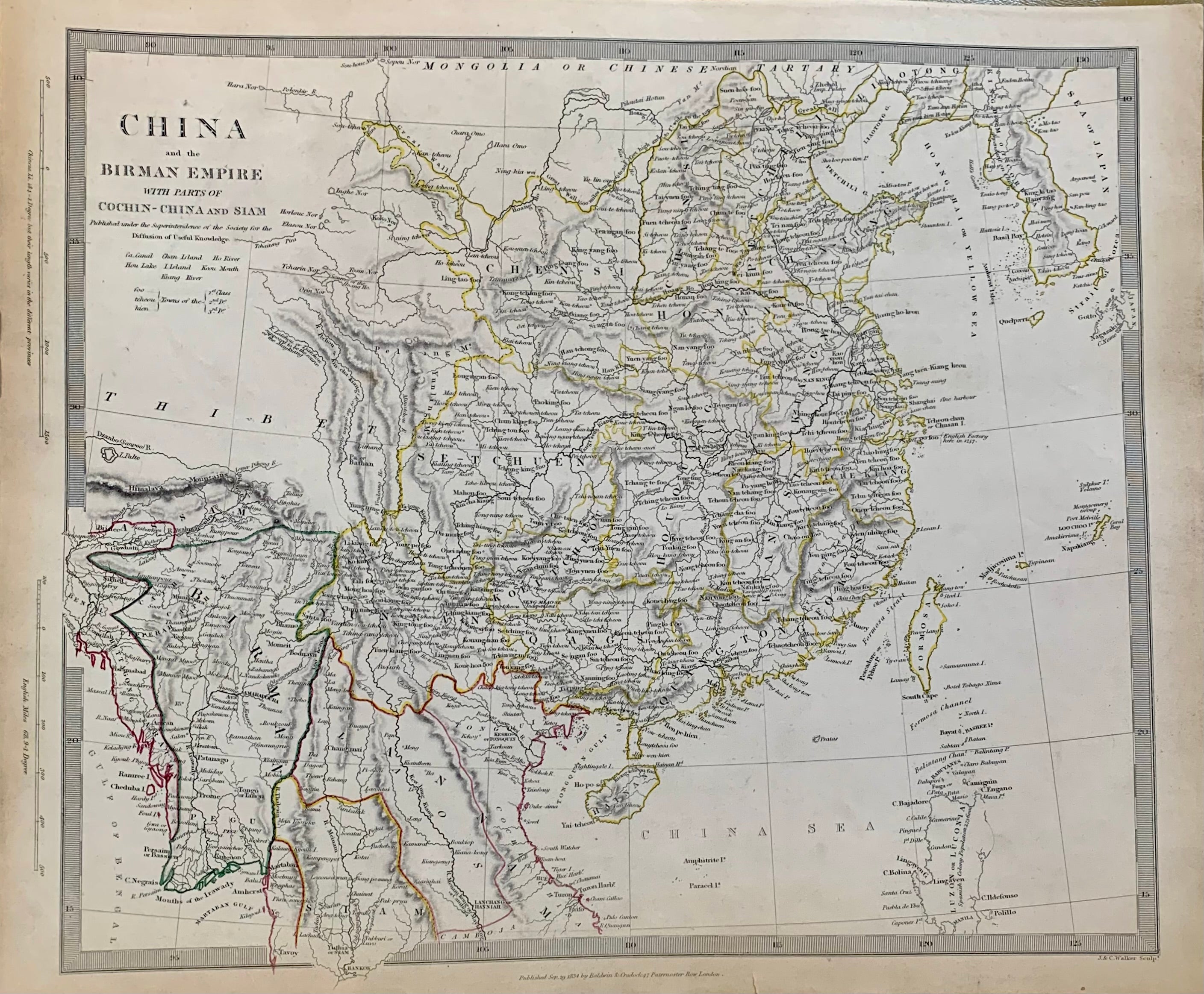
China; The Interior Chiefly from du Halde and the Jesuits 1710 to 1718 and the Sea Coast from Modern Aurhorities
London: Chapman and Hall, 1844.
Map. Lithograph with original coloring. Image measures 12 x 14.25. Sheet measures 13.5 x 16.25 inches. Small chip at right edge. In very good condition.
This beautiful map of China was issued in 1844 by the Society for the Diffusion of Useful Knowledge or SDUK. It depicts China from the Burma or Myanmar north to Chinese Tartary. Incredibly detailed, the map notes several important towns, cities, regions, rivers, mountains and other topographical features. The Great Wall of China is identified. This map is based on the map of Du Halde and the Jesuits from 1710 to 1718.
Jean-Baptist Du Halde, a French Jesuit historian specializing in China, collected missionary reports and provided the best description of Chinese history, society and culture to the world. He however never visited China.
The Society for the Diffusion of Useful Knowledge was formed in 1826 and published low cost maps with the goal of reaching a large market, while still maintaining high quality and precision.
Binding: Unbound
Language: English
Price: $250.00
Item #313656